


Google's Map Systems - Don't Trust, Always Verify
A trip to South Lake Tahoe amidst a winter storm exposes major flaws and threats to lives and safety. Don't ever rely on Waze or Google Maps in adverse conditions. Doing so might bring harm, or worse

It began when the pastor at a lovely Christmas Eve church service in South Lake Tahoe, California, made a gentle joke about Bakersfield.
He was citing how Christ’s influence on society includes the names of major California cities, such as San Francisco (“Saint Francis”) and Los Angeles (“City of Angels”). Insert comments here about the influence of Christianity on those cities today. (Saint Francis of Assisi today might file a defamation suit.)
Then the pastor mentioned Bakersfield and how that giant Central Valley agricultural and food processing mecca wasn’t named after anything related to Christianity. It was a gentle poke. “Unfair,” I muttered since, as a native Oklahoman, a good many of my forebearers made their way to Bakersfield during the Dust Bowl and Great Depression of the 1930s. Then again, a great many Californians have long thumbed their noses upon the largely working-class community known for its agriculture, food and other manufacturing, along with the entire Central Valley. Bakersfield, Tulare, Fresno, Modesto, Merced, Stockton, and scores of other communities where much of our nation’s “minor crops” - almonds, carrots, peaches, tomatoes, grapes, raisins, spinach, lettuce, garlic, grains, pistachios, oranges, etc. - are grown, processed and packaged here for the entire country (and beyond). Admittedly, none of these is the Valley’s top cash crop.
As the Central Valley goes, so do your food prices and availability.
As a food industry veteran, I’ve grown rather fond of Bakersfield. It is primarily represented in the US House by Republican Leader Kevin McCarthy and his GOP colleague, David Valadao. It has a street named after a favorite country musician, the late and fellow Oklahoma native Merle Haggard, who resided for a while at California’s Folsom Prison. But I digress.
Little did we know that our family would make its way back to Sacramento for our flight home (after a two-day delay) via Bakersfield. How that came to be is worth sharing, with lessons for all of us about those web and app-based map services on which we have come to rely—particularly Waze and Google Maps (both owned by California-based Google).

Little did we know that the pastor’s mention of Bakersfield proved prescient.
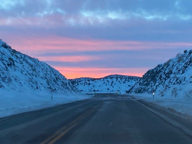
Those familiar with California know that Tahoe to Bakersfield to Sacramento is quite the diversion. It became necessary because of a massive 3-day snowstorm over the Sierra Mountains that blocked all vehicular traffic through and over every pass from north of Reno, Nevada south towards - but not including - the Inland Empire city of Bakersfield. The storm dumped upwards of nine feet of snow, unrelentingly. By day two, coupled with wind gusts over 60 miles per hour and fears of avalanches, almost every ski resort completely closed.
It made the locals happy for two reasons. First, once the storm clears, great skiing! Second, California’s snowpack charges many of the state’s aging reservoirs that supply farms and ranches with irrigation but of greater importance to most politicians is that it provides drinking water to millions of California voters. It has been a very dry fall and early winter thus far.
But there was a different story for those of us making a vacation trek.
It began for us early on Sunday morning when we added an extra hour to what should have been a 2.5-hour drive to Sacramento’s airport via US 50. We knew the weather was a potential challenge but had no information leading us to believe that roads were closed.
As is my custom, having loaded up our SUV rental, I plugged the airport’s address into my Waze app and was promptly told it would take 5 hours to arrive, putting us there long after our scheduled flights had departed. “We’re screwed,” I told my son, double-checking to see if it was a mistake.
Late the previous night, it indicated a classic 2.5-hour journey. Google Maps told us much the same thing. I knew something was wrong on the windy, mountainous US 50. The storm had shut down our ability to take the gondola to the top of our mountain for skiing most of the week. We began rebooking our flights to make it to Sacramento sometime that night. Our rebooked flights would leave early Monday afternoon. All flights out of Reno were booked for days.

Then I checked the route and decided to find any website or phone number that might provide road conditions and weather information. California’s Department of Transportation, CalTrans, has a website that provided some updated information and noted that it included data from Waze. They were coordinating with travel map sites and apps, I thought. It took us on a circuitous path towards Reno, Nevada, and a series of two-lane roads (state roads 70 and 89) over the northern Sierra, a 300-plus mile, six-hour journey. Caltrans’ website proved challenging to use and conveyed information very poorly. Its toll-free number for traffic information never worked.
Nowhere on Waze did it mention roads being closed. Google Maps was also eerily silent, happy to send us into an oblivion of dark, snowy, and closed roads in the middle of nowhere California.
But here’s where Google’s map system led us, and others, dangerously astray.
As we made our way past Carson City towards Reno, Waze informed us that it had saved us over 2 hours by finding a faster route, back towards Tahoe and on US 50 - our original plan. I found it frustrating and hard to believe, but I took the gamble and made yet another trip along the treacherous route back to where we had started. Again. We followed odd directions, with dozens of other vehicles towards US 50 East, to suddenly stop along with others along a rural, somewhat residential road. There we sat. And sat. And sat again, occasionally making very modest progress. Cars began to turn around. We made our way to the US 50 only to find a California highway patrolman blocking the road. My wife walked over to talk to him.
He told her that the road would be closed until at least Tuesday. This was Sunday. People were sitting in line late into the evening amidst treacherous conditions, expecting that US 50 was open, with no attempt of any kind to alert them. Likely thanks to Waze and Google. Vans with kids. Most of us with no prospect of hotel rooms in crowded Lake Tahoe. We decided to return towards Reno, again making our third trip of the day up US 50, like a replay from the movie Groundhog Day. Hours wasted that I would never get back, and further exposing my family to the risks of traversing snowy roads, this time after sunset.
As we made it north from Carson City to our turn onto California state road 70, we encountered a California Agriculture Inspection facility still open late that night. “Where are you headed?” the Inspector asked. “To Sacramento, eventually,” I wearily proclaimed.
“Not tonight,” he said, noting that some of my predecessors had argued with him. He mentioned how few snowplows had made it this way thus, motioning towards the snow piled up around his station. He suggested we head north to our exit, turn around, and head back to Reno for an overnight stay. He thought I-80 from Reno to Sacramento would be the first lanes to be reopened Tuesday (he could not say when and was eventually proven wrong. Not his fault).
I decided to investigate the road that was taking us into the snowy darkness. It was icy but passable at now-customary slow speeds. We passed one jackknifed trailer, and other abandoned trucks had spun or slid off the road. We knew from experience early in the day that internet and cellular coverage would be nonexistent, making access to information - or a request for help - impossible. Total darkness with mountain passes ahead, other than our headlights.
Then, a new message from Waze showed up. A 77-minute delay due to closed roads would estimate our arrival in Sacramento at 3 a.m. We decided to follow the Inspector’s wise counsel and found one of the last hotel rooms near the Reno airport as we rebooked our flights again. Kudos to American Airlines for its superb customer assistance (United Airlines, not so much). Why does Waze tell you that you will still reach your destination when it reports that roads are closed?
The following day, we again tried to gather as much information as possible, which proved frustrating. While I-80 road cams and other information existed, we had no luck finding out when the road may open up. Google Maps suddenly began catching up to reality. Every road that we would have traversed the night before was closed for dozens, if not hundreds of miles. Every pass over or through the Sierra was closed, all the way down to Yosemite. We thanked God that we chose to return to safety in Reno.
We fumed over the miscommunication from nearly every source we encountered, other than the Agriculture Inspector. I’m glad we followed his advice.
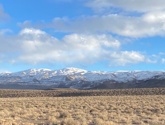
After a late breakfast, my wife overheard a nearby table discussing that the only way to get over the Sierra’s was around it south towards the town of Bishop, California, whose roads were open (to the best of his knowledge) towards Bakersfield. I found it on the map, some 300 miles south along the eastern side of the Sierra. Add to that another 250 or more miles through the Montgomery Pass in Nevada and Chalfont Valley in California towards Bakersfield, then another 200 miles up Highway 99 to Sacramento. Unlike the Google Map above, it was not quite 839 miles, and it did not take 14 hours (it seemed like it). We arrived at our Sacramento hotel at 1 a.m., 12 hours after our decision in Reno to risk the journey. We would wake at 5 a.m. for an 8 a.m. departing flight. The hotel clerk advised us that they had 17 cancelations that night - possibly people with the same plans we once had but lacking the grit (some might say, insanity) for a nearly 800-mile flanking maneuver around the Sierra’s.
I will say this: Western Nevada is beautiful, and McCormick’s Pass at sunset is stunning.
As an amateur historian, the 1863 Battle of Gettysburg came to mind. It culminated on July 3rd that year in a direct frontal assault of Confederate troops against a highly fortified Union centerline. One of Robert E. Lee’s generals, James Longstreet, had advised a maneuver around the Union army and invited an attack on the Confederates on favorable defensive grounds towards Washington. Longstreet’s advice was rejected, and we know what happened. I did not want to repeat Lee’s mistake as we attempted to conquer the winter storm. We moved around the storm onto better highways and a more favorable climate, sans snow. We traversed comfortably and uneventfully towards our destination, victory at hand, albeit an exhaustive one.
But Google wasn’t done trying to kill us.
After filling up our gas tank in the lovely town of Big Pine, California, Google Maps wanted us to turn around and head back into the Sierra Mountains towards Mammoth Lakes, Mono Lake, and back towards Tahoe for a “shorter” drive on mountainous roads we knew were closed. But we would not be fooled again, sticking with our snowless Inland Empire journey towards Sacramento, passing steaming food processing plants and other manufacturing facilities that dot both sides of highway 99.
As I write this, we are still trying to get home. We are safely ensconced for the moment in Dallas where we await yet another new connection due to a delayed departure from Sacramento. It will be another late night. Except for this time, I won’t be driving some 750 miles. In all, we put 1,300 miles on our rental car, most of it during the past two days.
Some may ask why we didn’t just drive to Las Vegas or Los Angeles and take flights from there. It was a shorter drive to LA from Bakersfield than towards Sacramento. But LAX was experiencing massive flight cancelations due to COVID, and the logistics of finding flights and dealing with a rental car drop-off seemed more cumbersome. Since we had flights booked with few cancelations out of Sacramento, the drive was worth it. We took a bird in the hand over two in the bush despite a long drive. There was little appeal in driving through Los Angeles at night for an uncertain future at LAX, not one of America’s finest airports.
Two more lessons. First, I will never rely on Waze or any Google mapping system for information, especially in adverse conditions. People like us relied on their service and risked our safety in the process. Google’s lousy direction to send us in harm’s way was dangerous and misinformed, not once but several times. CalTrans needs to work on its dissemination of information, which is weak, including realistic projections and mapping of its own precisely where closures are occurring and when roads might open (they provide no such direction or estimation). Better internet coverage along some routes in the mountains around the region would be valuable. Mapping apps and technology still have a ways to go. Maybe Elon Musk could step up here, given his investment in satellite technology. Perhaps Microsoft should consider a major upgrade with more real-time traffic information to its Bing mapping software to eclipse Google’s Waze. I know other services are out there. This is their opportunity.
Second, I will never make fun of Bakersfield. On this journey, even at night, it was a sight for sore eyes.
A truck driver told us that CalTrans also is short of people to operate snowplows. I wonder if that is true also in other northern climates?
Bakersfield proved a valuable and welcome landmark on our successful journey. And many of the roads from Tahoe and Reno remain closed until Thursday, including I-80, clobbered by an avalanche today. Our original route (US 50) opened briefly on Tuesday but closed again due to a jackknifed trailer.
We feel validated in our decision and appreciate the stories and experiences of our journey; even it was no way to spend part of a Christmas holiday. Many of our California friends and family thought we were crazy but wished us well, some sharing advice and information. As for us, we’re planning on a warm and sunny beach next holiday season and will save our ski trips for Colorado, where they seem to handle the snow (and other things) much more effectively.